
companies of best drone equipments DJ® UAV parts, camera PTZ for professional aerial photography! suppliers of affordable quadcopter DJ® drones with camera for transport,plant protection in china.
aerial photography drones are unmanned aerial vehicles equipped with cameras or other imaging devices designed to capture images or videos from an elevated perspective. these drones are commonly used for various purposes, including photography, videography, surveying, mapping. they provide a cost-effective and flexible alternative to traditional methods of aerial photography, such as manned aircraft or helicopters.
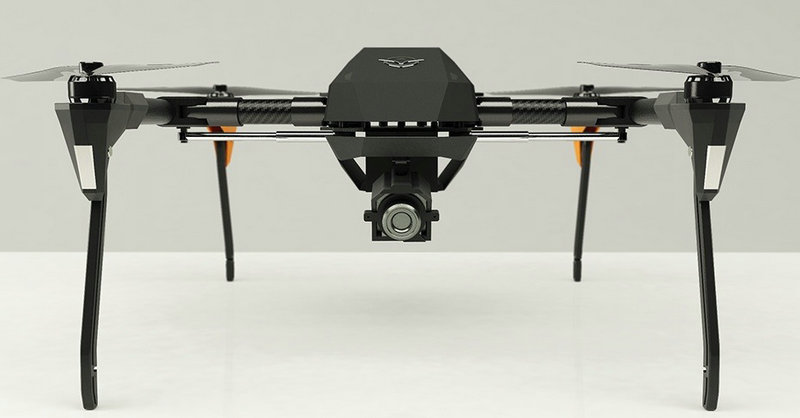
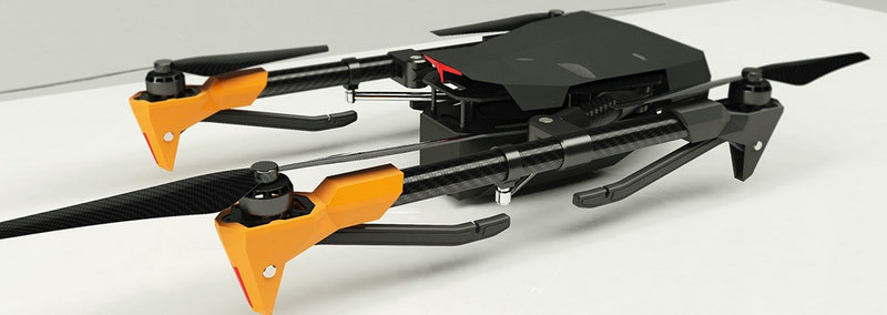
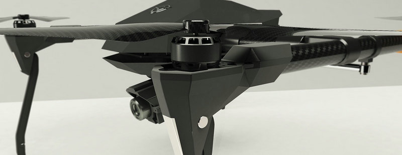
aerial photography drones are equipped with high-quality cameras that can capture still images or record videos. some advanced drones have gimbal stabilization systems to ensure smooth and steady footage.
aerial photography drones come with global navigation satellite system technology, allowing for precise navigation and the ability to set specific flight paths. this is especially useful for mapping and surveying applications. it can control drones remotely using a dedicated controller or a mobile device. aerial photography drones also support autonomous flight modes, where they can follow a pre-programmed route or automatically track a subject.
drones often provide real-time telemetry data to the pilot, including altitude, speed, battery level, and more. first person view systems allow the pilot to see what the drone's camera sees in real time, enhancing the ability to frame shots accurately.
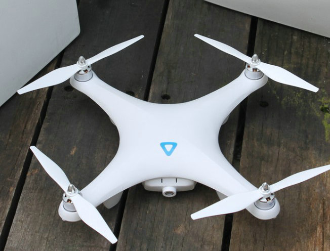
aerial photography drones are equipped with obstacle avoidance sensors to prevent collisions during flight. This feature is particularly valuable when flying in complex environments.
aerial photography drones have a wide range of applications, including: film and video production: creating cinematic shots and capturing dynamic footage for films, documentaries, or advertisements. mapping and surveying: conducting aerial surveys, mapping landscapes, and monitoring construction sites. search and rescue: using aerial photography drones to cover large areas quickly and locate missing persons or assess disaster-stricken areas. environmental monitoring: monitoring wildlife, tracking changes in ecosystems, and assessing environmental conditions from above.
| types | HY-FOA-820 | ||||||||
| wheelbase | 900mm | ||||||||
| drone weight | 3470g | ||||||||
| load mass | 5000g | ||||||||
| satellite positioning module | GPS, Beidou, GLONASS | ||||||||
| endurance time | 40 minutes | ||||||||
| control radius | 10km | ||||||||
| maximum flight speed | 88km/h | ||||||||
| flight altitude | 5000m | ||||||||
| Maximum wind resistance level | level 7 | ||||||||
| battery type | Smart lithium battery | ||||||||
| battery capacity | 29000mAh | ||||||||
| obstacle avoidance function | support | ||||||||
| flight control | Multi-attitude flight modes such as fixed altitude, fixed point, autonomous cruise, one-button takeoff and landing, low voltage protection, automatic return to home, preset no-fly zone, electronic fence | ||||||||
| operating temperature | -20~60C | ||||||||
| expand size | 717(W)*755(D)*520(H)mm | ||||||||
| quadcopter drones, mini UAV,camera drones, best UAV, adults drones, big UAV systems, drone toys,unmanned aerial vehicle UAV parts,flight control systems,communication systems,navigation systems | |||||||||
|---|---|---|---|---|---|---|---|---|---|
- home
- products
- contact
- equipments
- UAV
- camera drones
- fixed wing UAV 200
- VTOL aircrafts 220
- hand-throwing fixed-wing UAVs
- quadcopter drones 820
- huge hexacopter UAVs 1550
- big hexacopter UAVs 1100
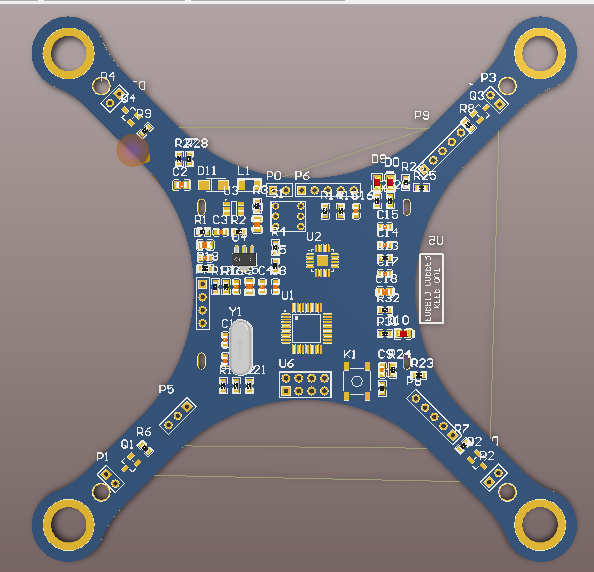
- drone PCB
- mini drones 180
- PTZ gimbals
- hydrogen powered drones
- drone LiDAR cameras
- FPV drones
- drone hangar
- underwater robotics
- unmanned helicopters
- drone swarms
- aerial photography drones
- agriculture drones
- inspection drones
- police drones
- emergency drones
- logistics drones
- mapping drones
- mining drones